4000
BC
to
1000 AD |
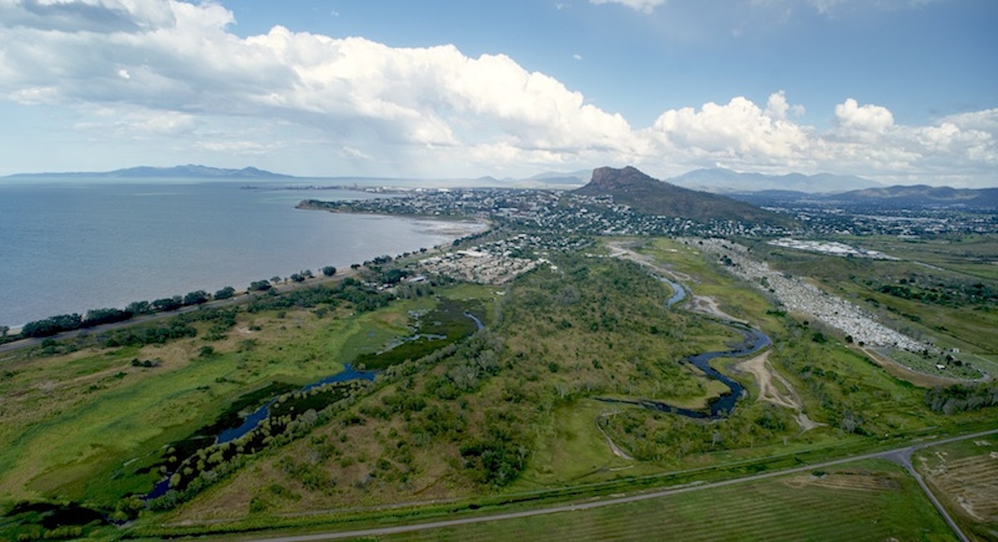
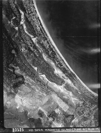
Coastal
and catchment processes acted to form the dunes, coastal plains and
waterways and create the Rowes Bay wetlands and associated landscapes
from Kissing Point to Many Peaks Range. The system of dunes and swales
extends approximately 2.75 kilometres inland from the existing
coastline. |
| ???? to +19?? |
Aboriginal
Traditional Owners would have used the wetlands as part of their range
for hunting and gathering food and other resources. The sand island may
have been used as a seasonal camping area. |
1864
|
Establishment of Townsville by European settlers. |
| 1865 |
Market
gardens and a dairy farm established near Jimmy’s Lookout. Vineyard
established at Kissing Point.
|
| 1869 |
The
Townsville Town Common is gazetted (GG 26.6.1869) and includes the
Rowes Bay wetlands.
|
| 1870s |
The
vineyard had closed down and the market garden area was being called
German Gardens. The Town Common is in use for pasturage of town
residents and visitors cattle and horses.
|
| 1874 - 1891 |
Development of the Townsville Port breakwaters.
|
1900
|
Residential
housing
starts to extend towards Rowes Bay
|
| Early 1914 |
The Townsville Town Common is gazetted as a Pasturage Reserve under new land administration legislation (The Land Act of 1910). |
| 1914 - 1918 |
World War I. German Gardens renamed Belgian Gardens |
| Early 1920s |
Heatley’s Parade and the road to the Pallarenda Quarantine Station were constructed |
| 1924 |
The Sanitary Reserve was established from the Pasturage Reserve. It included much of the current Rowes Bay wetlands |
| 1939 |
Townsville airport/military base established |
| 1939 - 1945 |
World War II |
| 1940s to 1960s |
Tidal mudflats between Castle Hill and Kissing Point are ‘reclaimed’ for residential development |
| 1950s |
Most of Belgian Gardens and North Ward streets had been laid out |
| 1961 |
The population of Belgian Gardens (129 houses), North Ward (113 houses) and Rowes Bay (76 houses) had swollen to around 1600 |
| 1960s |
Most of the Rowes Bay street network had been laid out. The One Mile Creek drain was nearing completion, replacing the lower 0.8 km of Mundy Creek, as part of the Town Common drainage works. |
| Dec 1971 |
Cyclone Althea see Bureau of Metreology report (4.6 Mb) |
| 1974 |
Mundy Creek channel reclaimed and built on (Built score = Belgian Gardens 151 houses, North Ward 129 houses and Rowes Bay 88 houses). |
| 1970s |
RSL retirement village was built comprising some 70 villas. |
| 1990s |
Another 2.5 hectares of wetlands were approved for reclamation to extend the RSL retirement village |
| 2007 |
Creek to Coral headquarters is established at the Rowes Bay wetlands reserve |
| 2007- 2010 |
Borrow Pits to Rowes Bay Learnscape brochure. |
| 2010 - 2012 |
The first ‘formal’ stage of the Rowes Bay wetlands tracks and trails are constructed including a boardwalk and return woodland track. |
| 2012 |
The Rowes Bay Wetlands Learnscapes Boardwalk and website launched |